Is German Train Travel Faster North↔South or East↔West?
Years ago I wrote short stories. For many of these I now look back and cringe. For this question, I suspect I shall look back at it similarly. However I think it's important to record this otherwise I'll have nothing to look back on, which is worse.
As is often the case when I am in Germany, the topic of (painful) train travel came up, and in particular: is it quicker to go North↔South or East↔West? Me being me, I wondered if I could answer this with data.
The TLDR is: maaaaaaybe. You can see the notebook for more detail on where I got to, but my approach was, in summary:
- Find all cities in Germany.
- Create all pairs of cities that traverse a North↔South or East↔West boundary.
- Find shortest travel time between these cities.
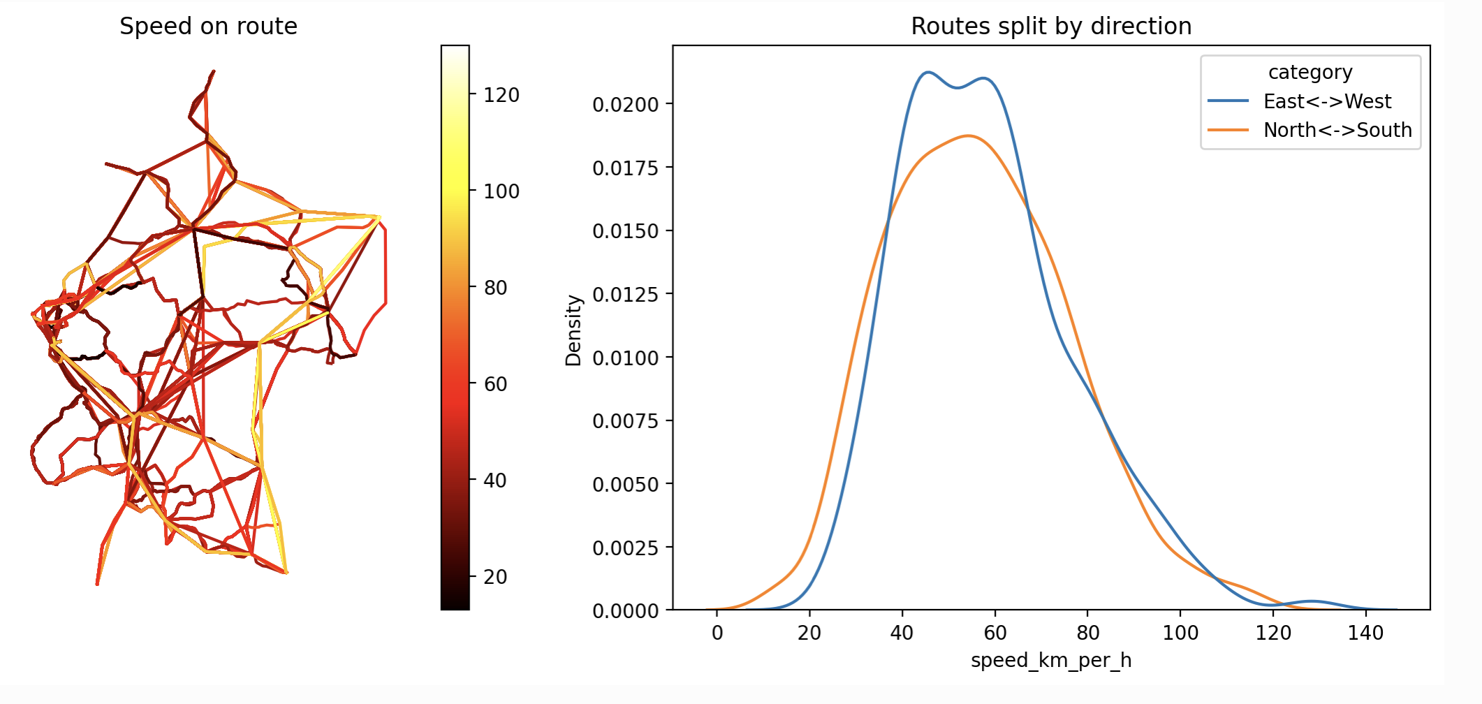
- Compute speed by dividing travel time by crow-flies distance between cities.
- Group routes into North↔South or East↔West and plot a distribution.
The overall outcome can be seen in the image at top: there doesn't seem to be an obvious difference. I could be more rigorous about this by doing a statistical test, but I think there are bigger issues to deal with.
As is often the case, doing an initial investigation just reveals problems with the definition of the question 😀. For example, if I look at the distribution of crow-fly distances, by normalising to speed, am I ignoring something of interest?
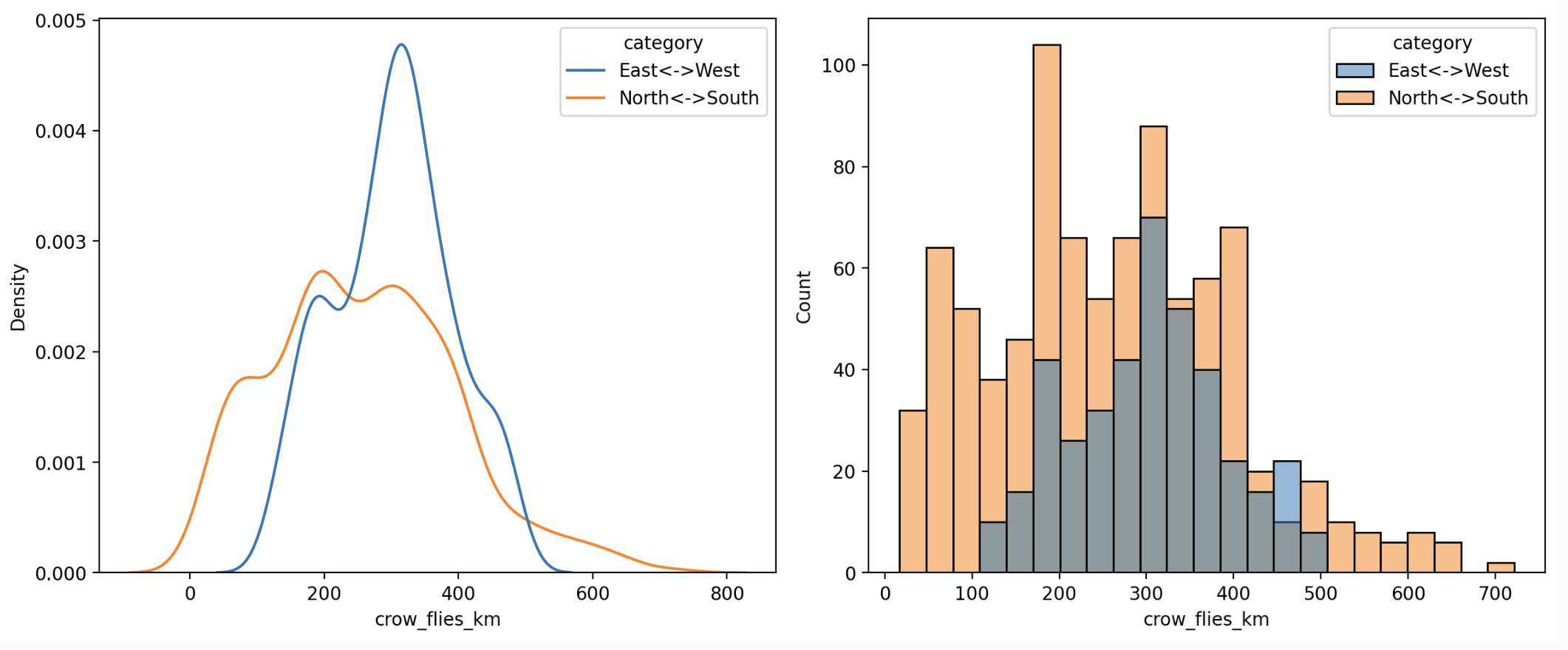
Is it maybe that East↔West journeys are generally longer than North↔South? Perhaps not. If you look at the map of cities you can see there is a cluster of cities near the North↔South boundary.
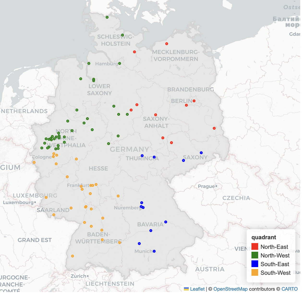
This will introduce a bias in that it will produce a bunch of routes that are short.
There is also the issue that I am (arbitrarily) choosing 9am on 10th Jan 2026 as the departure time.
I only wanted to spend a day on this, so I won't take this further for now. However, if I did, I'd probably want to instead do something like:
- Prepare:
- Collect: for each pair, for 24h throughout the day, in 1h steps, find fastest travel time.
- Analyse:
- Do something like before but, since there may still be bias from how often routes of different lengths occur between areas, I probably want to bucket by route length and compute an average.
- This will give me more of an unbiased summary. However, since population distribution isn't unbiased, I probably want to rebias the sample by wieghting towards where more people live. This gives more of an idea of what a typical experience would be like.
Anyways, I'm not gonna do all that now 😀.
One thing I will probably do sooner is re-use the motis server setup. It was a massive pain trying out many public/private libraries/services for travel times, and finding various versions of broken-ness or "please talk to sales" road-blocks.
Motis worked really well out-of-the-box and could easily handle all of Germany on my Macbook Air; only took about 20 minutes to import the data, and then lookups were fast. Also, even though I was using it for API only, the nice UI for inspecting / debugging was a great bonus.
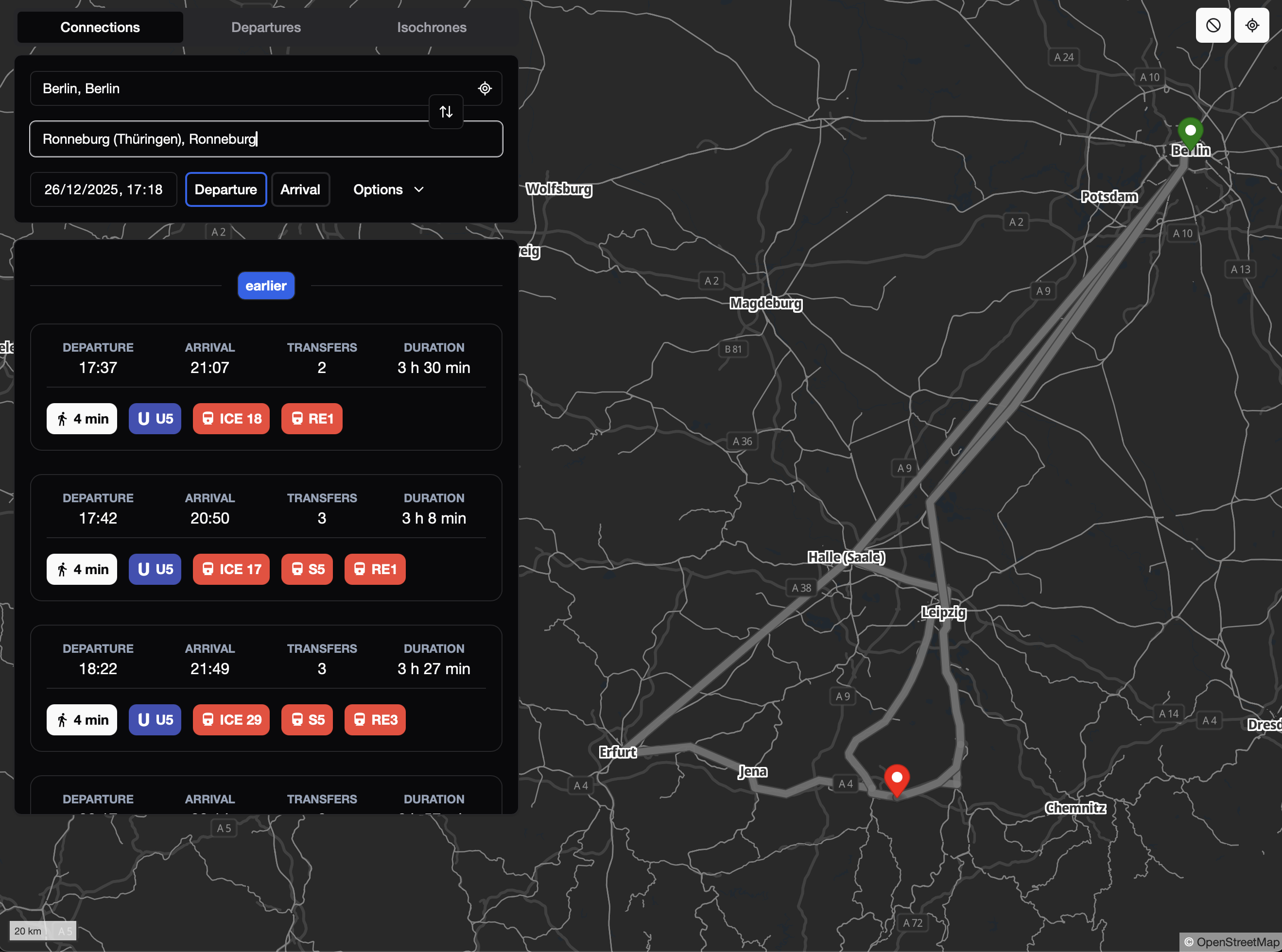
Even better, it's based on open-data for Maps and Timetables!